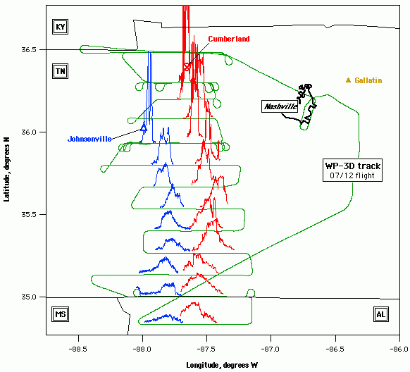

A map of the 1999 Southern Oxidants Study region is shown with the NOAA WP-3D aircraft flight track overlaid in green. On July 12, 1999, emissions plumes from large coal-fired power plants at Cumberland and Johnsonville were intercepted during longitudinal transects performed at multiple distances downwind. Measurements of nitrogen oxides, sulfur dioxide, and ozone carried aboard the aircraft permit atmospheric dynamics and photochemistry occurring in these plumes to be studied during this experiment.
Measurements of total nitrogen oxides (NOy, shown in red) and sulfur dioxide (SO2, shown in blue) are plotted relative to aircraft position to depict the transport of emissions downwind of the power plants. The vertical distance between the horizontal flight segments and the measured data is proportional to the observed concentration enhancement above the local background.
Experiments such as these are used to refine understanding of the effects of anthropogenic emissions on atmospheric ozone and aerosol production and loss processes.
Submitted by Tom Ryerson.

Forum

Support

Gallery
Igor Pro 9
Learn More
Igor XOP Toolkit
Learn More
Igor NIDAQ Tools MX
Learn More


