
This is a wind barb plot of a frontal passage with strong south winds in Houston, TX during September, 2006. Raw data consists of u and v wind components, hourly averaged, at 60m intervals starting at 128m above ground level. Data source is the LaPorte Airport Radar Wind Profiler, acquired by the University of Houston during the TexAQS-II study to examine air pollution in SE Texas.
A radar wind profiler is a fixed position instrument that transmits/receives radar signals with 5 antennas. The Doppler shift of the backscattered signal is used to calculate the windspeed (away from or towards the instrument, in all dimensions) as a function of altitude.
Submitted by Patrick Wright, University of Houston, Department of Earth and Atmospheric Science

Measuring Solar Radiation in Greenland
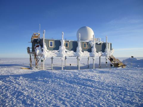
In May of 2011, Patrick measured solar radiation at the Summit Ice Station in Greenland. He sent this picture from the ice station

Snow Albedo
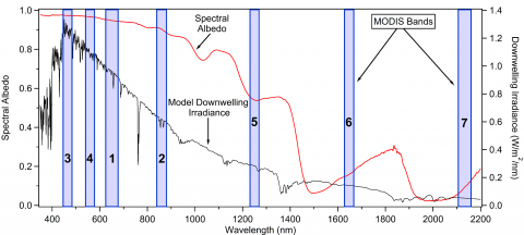
In 2014, Patrick and colleagues published a paper in Remote Sensing of Environment, 140, 118-129, entitled "Comparing MODIS daily snow albedo to spectral albedo field measurements in Central Greenland". Here is a graphic from that paper

Forum

Support

Gallery
Igor Pro 9
Learn More
Igor XOP Toolkit
Learn More
Igor NIDAQ Tools MX
Learn More


